Chatter News Photo Galleries and Information ________________________________________________
| Chatter News | Road to Vertebrae Glacier | Glacier Skiing | Bombardier Snowcat | Favorites |
| Lodge Life | Vertebrae Lodge | Solitude Lodge | Happy Campers | Pink Purse | Winter Staff |
Ski Photography by: | John Dougall | Mark Gallup | Dan Hudson | About Us | Site Map | Index |
| Chatter Creek Cat Skiing | Clamshell | Cut Blocks | East Ridge | Lodge Ridge | Great Links |
| Cat Skiing Terrain | Cat Skiing Articles | Flight to Chatter Creek | Travel to Golden | Email |
Terrain Quick Links: | South Side | West Side | Lodge Ridge | Stovepipe | Glacier | East Ridge |

Sunday, May 01, 2005

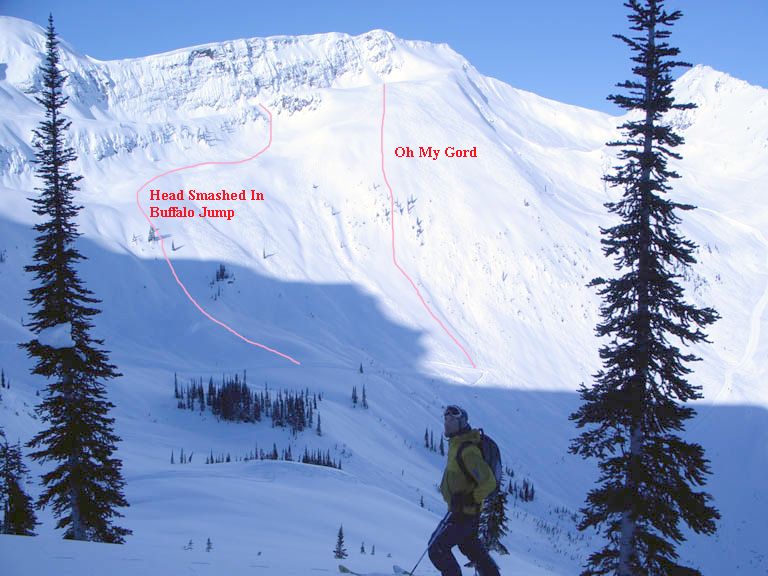
South Side Cat Skiing Terrain

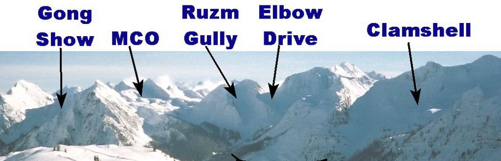
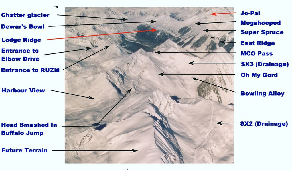
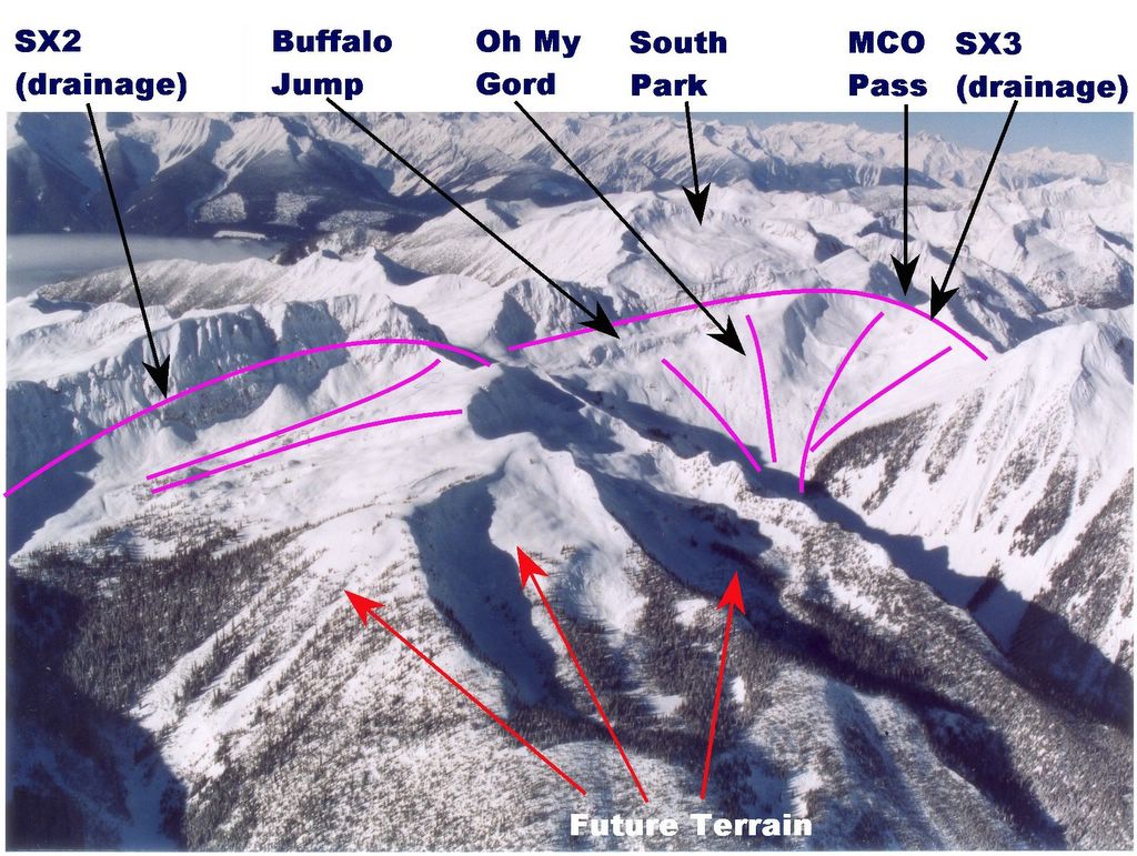
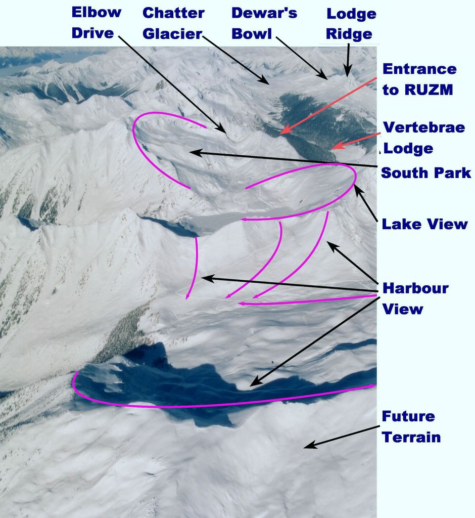
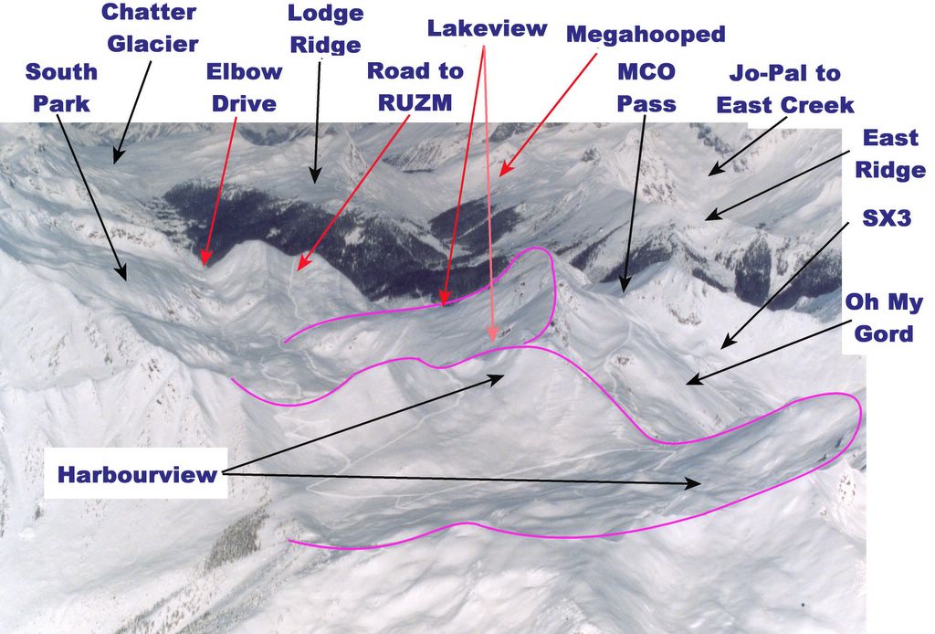
The South Side Super Road leaves Vertebrae Lodge to the south. From the Chatter Creek Main, it climbs to MCO (Multiple Cascading Orgasms), where it forks with westerly branches to Elbow Drive and RUZM Gully (Right Up Ze Middle)and an easterly branch to the Gong Show. A branch also forks to the southeast to climb over MCO Pass to service SX3 and SX2. After crossing MCO, the road continues to South Park and on south to Lakeview and to Harbourview.

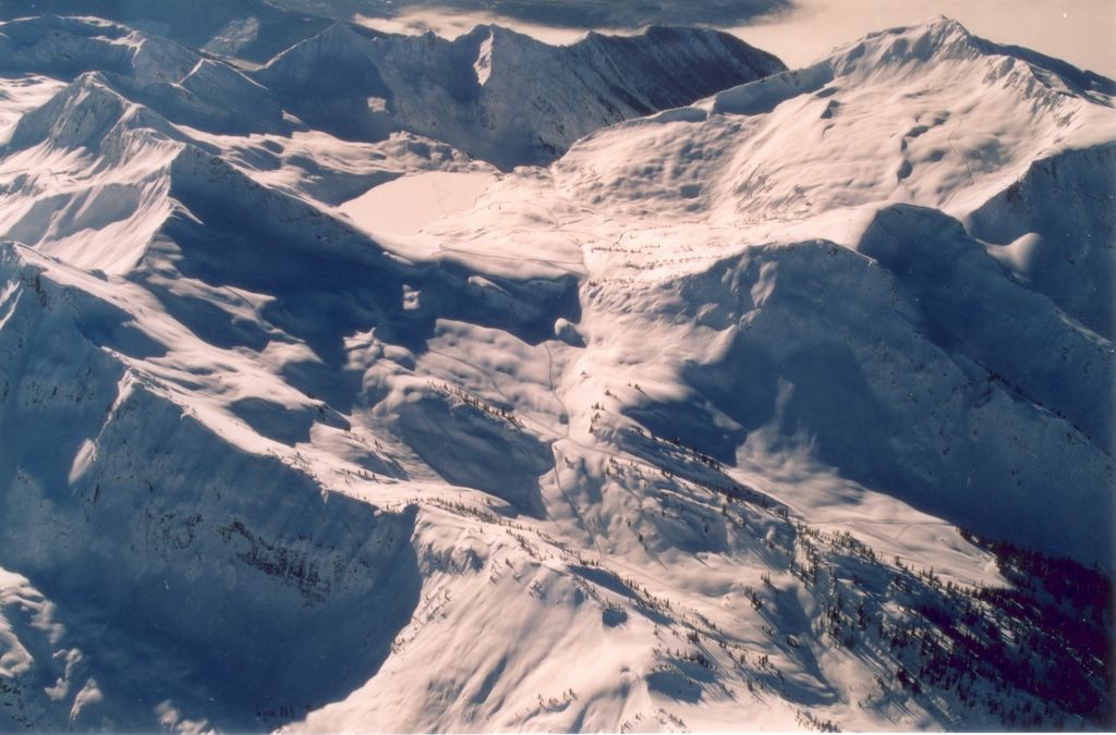
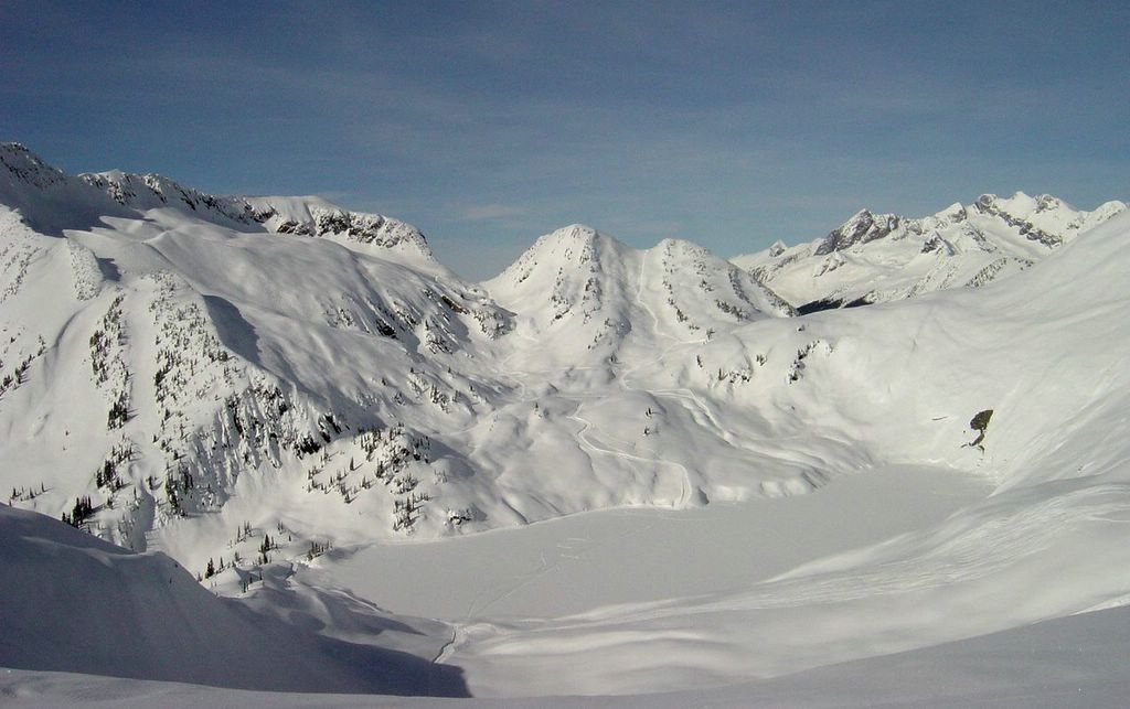
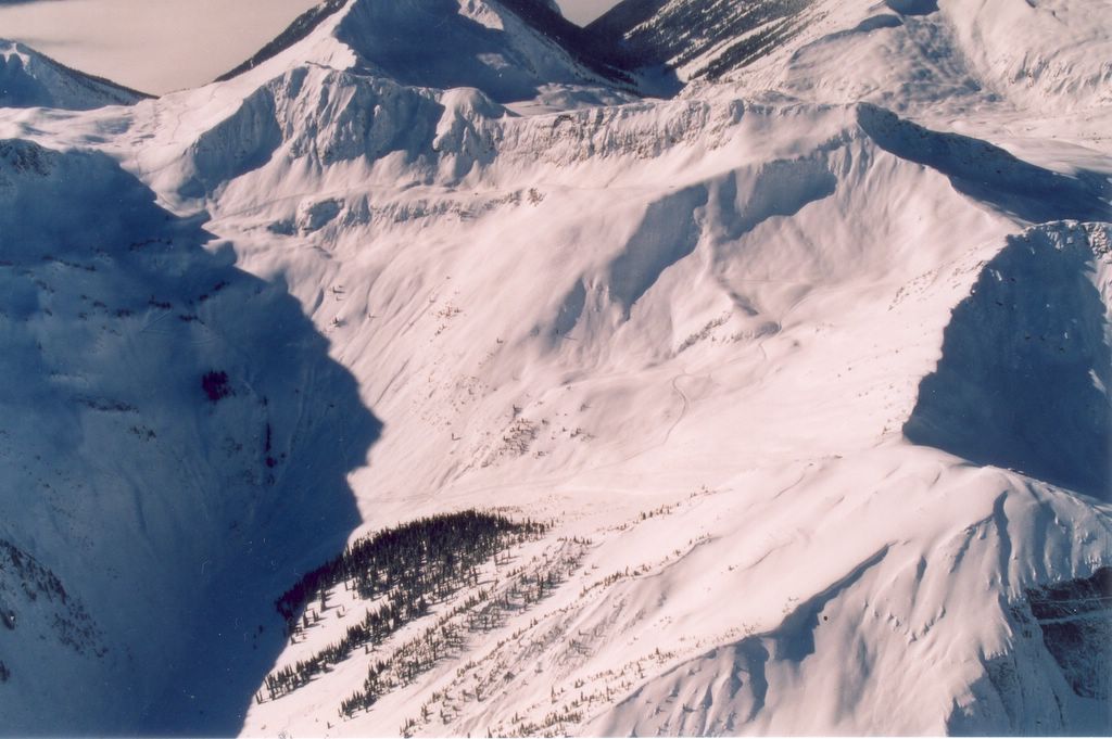
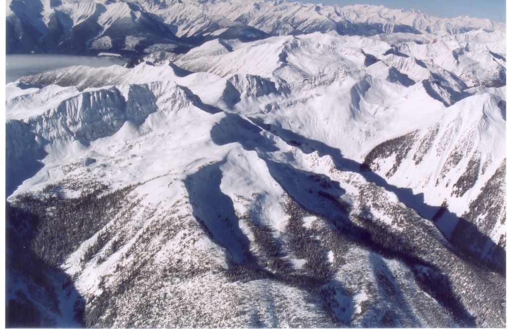
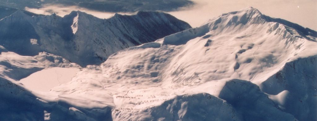
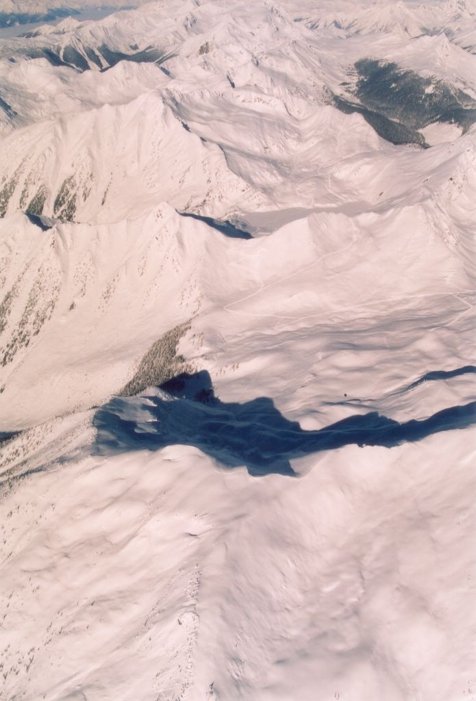
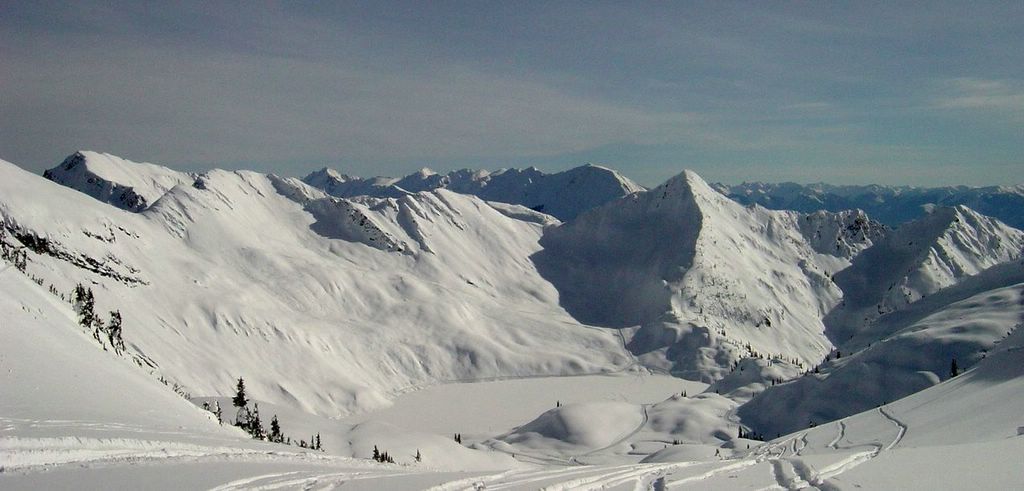
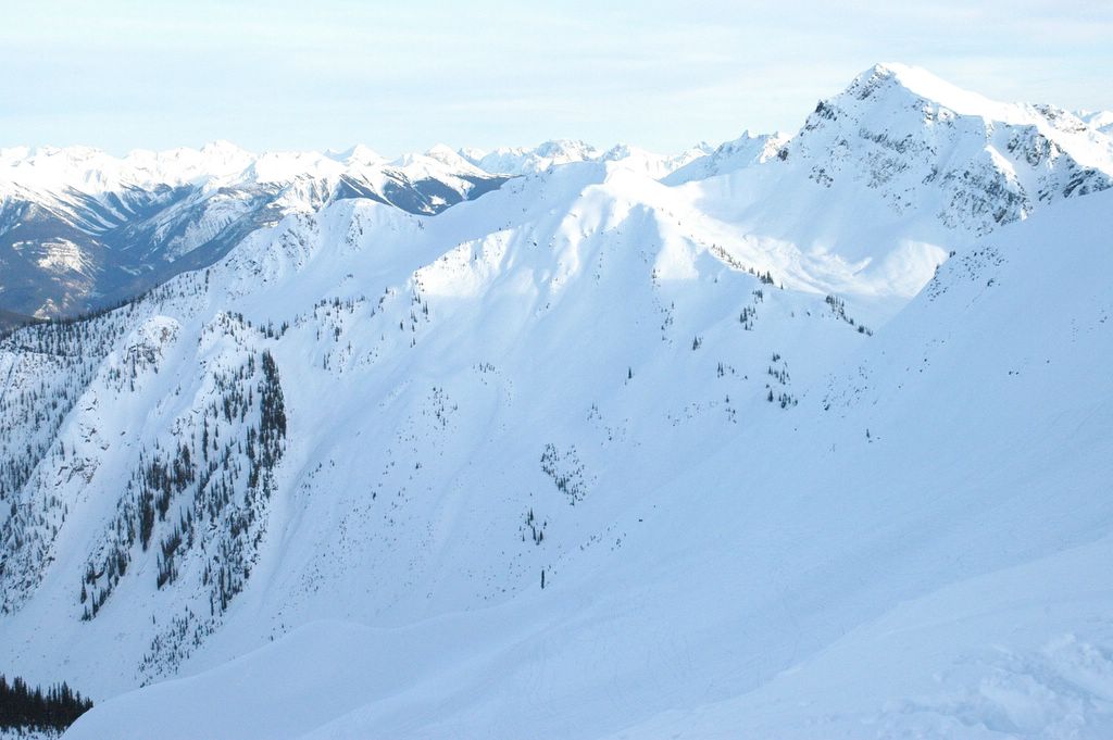
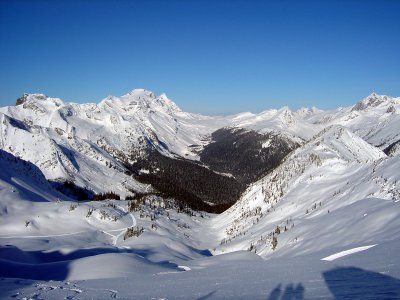
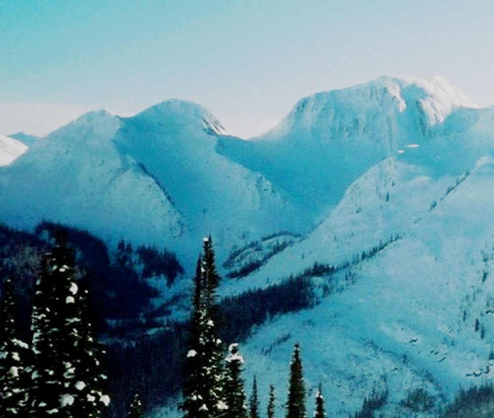
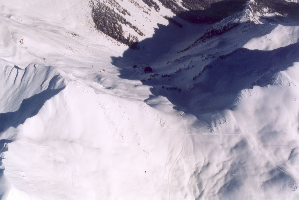
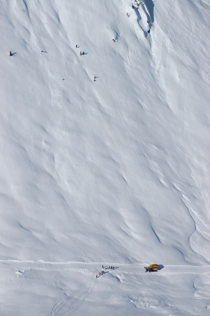
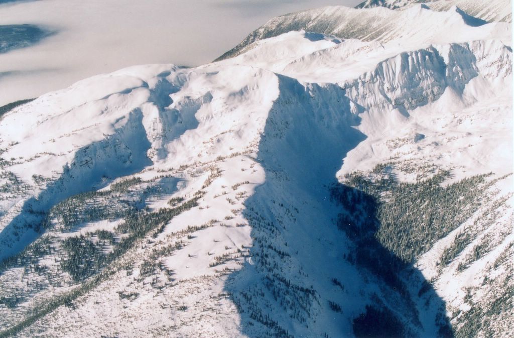
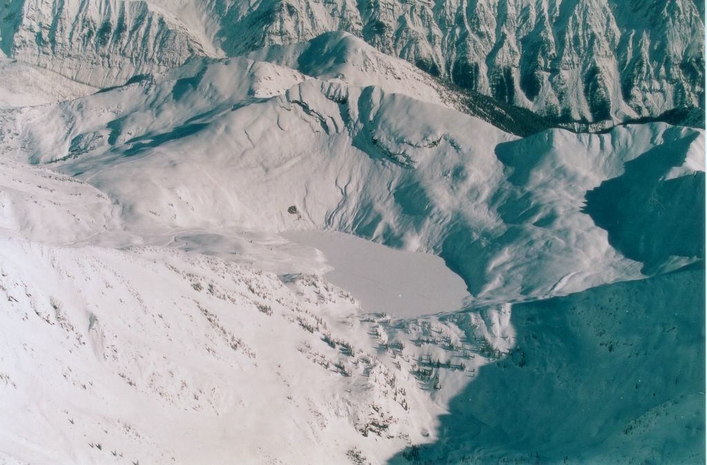
The helicopter flight to Chatter Creek passes over much of the "South Side" cat skiing terrain. Scroll down to view the major ski zones in Chatter Creek's South Side. If you're looking for a particular Chatter Creek ski run, or any Chatter Creek name, try our Ski Run Index.
                                        Return to Road Network Index

Aerial View South from Vertebrae Lodge

Aerial view of the Ski Terrain sout of Vertebrae Lodge
The view looking south from above Vertebrae Lodge. The alpine areas above the center of the photo include MCO, RUZM Gully and Elbow Drive. Part of the Gong Show can also be seen. In the lower half of the photos, Staff Trees are seen, opposite the Home Run cut block at the base of Lodge Ridge. Vertebrae Lodge is located at the edge of the Home Run clearing at the bottom left hand corner of the photo.

Click on the photo above to enlarge it, then use the "Back" button to return. Click on the photo to the right to see the names of the ski runs and features shown in this photo.

Chatter Creek Cat Skiing thanks Steve Neill of Alpenglow Aviation for the wonderful aerial photography displayed on the Chatter News.

Saturday, April 30, 2005

MCO and South Park at Chatter Creek Cat Skiing


MCO (Multiple Cascading Orgasims) crosses the photo from left to right, dropping from MCO Pass. South Park rises in the background from above center to the top right hand corner of the photo. At the top of MCO, a cat road crosses MCO Pass east (left) to service SX3, which is just visible on the left of the photo. SX2, beyond SX3 is also serviced by this road. Beyond MCO and to the south (left) of South Park the lake is visible at the bottom of Lakeview. However, the Lakeview skiing terrain is hidden from view. Even further south, in the top left corner of the photo, Harbourview is just visible, in the sun.

The flight path of the helicopter flight to Chatter Creek passes over the center of this cat skiing terrain.

Click on the photo to the right for the names of runs. Scroll down to see more of the south side ski terrain at Chatter Creek cat skiing.


South Park and the entrances to Elbow Drive and to RUZM as seen from Lakeview. The road to RUZM climbs to the small col in the low hill in the center of the photo. The road to Elbow Drive passes through the valley on the left, between South Park and the low hill. Jo-Pal and Wonderland can be seen in the background, on the right.

Friday, April 29, 2005

MCO Pass, SX3 and SX2 Drainages


The right side of this view from the south shows the SX2 (nearest) and SX3 drainages in the Sunnyvale area. The more distant SX3 drainage includes the "Bowling Alley", "Oh My Gord" and "Head Smashed In Buffalo Jump". Above the center of the photo, Staff Trees and then the trees of Lodge Ridge can be seen beyond MCO Pass.

On the left of this photo, part of Harbourview can be seen just below the center of the photo. Lakeview lies hidden, and the foot of South Park can be seen in the upper third of the photo.

Click the photo to the right to see the run and area names in this region.

Thursday, April 28, 2005

The SX3 Drainage at Chatter Creek Cat Skiing


The upper SX3 drainage viewed from the east. "Oh My Gord" is in the middle of the photo and "Smashed in Head Buffalo Jump" is above center, slightly to the left. Part of South Park can be seen at the upper right hand corner of the photo. MCO Pass and the Bowling Alley are hidden by the ridge in the forground and on the right. Runs in SX3 extend through the unnamed trees at the bottom of the photo.

The two aerial photos to the right are taken from above two passes into SX3, the first from above MCO Pass, the second from above the pass from Harbourview. In the first, a cat road servicing runs back into MCO can be seen along the ridge of MCO Pass. In the second, the top of SX2, the next drainage to the south, is just visible.

Click the photo to the right to see the names of the ski runs and areas in and about upper SX3.

SX2, SX3 and South Park Viewed from the East


The SX2 drainage is under the cliff and the SX3 drainage is to the right. South Park can be seen beyond SX3. MCO Pass is in shadow above and to the right of SX3. The treed bowls in the forground will provide future cat skiing terrain. Click the image for a better view.

Beyond the cliffs at the western edge of SX2 lies a large amount of future ski terrain, shown in the photo to the right.

Click the second image to the right to see the names of the cat skiing areas shown above.

South Park


South Park, southwest of MCO and beside the lake in the Lakeview drainage. The photos to the right show parts of the South Park ski terrain. Click the "South Park" link for more images.

South Park, Lakeview and Harbourview

In the top third of the photo lies South Park , to the left of the distant trees on Lodge Ridge. South Park slopes from left to right , almost into Lakeview, which is the next bowl closer to the camera . Lakeview is a drainage that empties to the left of the photo. Next closest bowl to the camera, just below the center of the photo, is Harbourview, partly in the shadow of its southern rim. The area at the bottom of the photo has not yet been been opened up for cat skiing at Chatter Creek.

Click the photo to the right to see the names of the cat skiing areas and runs show in the photo above. Click on the second photo on the right for a slightly different view of the South Side Ski Terrain. This second view also gives a broad panorama of East Ridge, Megahooped, Spruce Pass, Lodge Ridge and the Chatter Creek watershed. The unmarked image follows directly below the annotated image.

Wednesday, April 27, 2005

Lakeview

The Lakeview Ski Terrain at Chatter Creek Cat Skiing
Lakeview bowl lies south of Chatter Creek's Vertebrae Lodge. The large bowl called South Park slopes into the lake from the left. The next bowl to the north of Lakeview is MCO. Beyond MCO, East Ridge is visible, with Super Spruce to the left of the trees and the Enchanted Forest to the right. Vertebrae Ridge lies beyond East Ridge, at the top of the photo. A second view of Lakeview is shown on the right.

Tuesday, April 26, 2005

Powder skiing terrain at Lakeview in the Chatter Creek snowcat skiing tenure
Lakeview taken from South Park.   Lakeview is one of the many drainages to the south of Vertebrae Lodge. There is excellent powder skiing on three sides of the lake, which drains to the West, into Kinbasket Lake.   Harbourview lies beyond the far ridge.

Sunday, April 24, 2005

Harbourview

The Harbourview Ski Terrain at Chatter Creek Cat Skiing
Harbourview is a large bowl located to the south of Vertebrae Lodge. The next bowl to the north is Lakeview, visible at the far left of the photo. Part of SX3 is visible behind Lakeview. SX2 lies hidden behind Harbourview, to the right of SX3. The area at the far right of the photo is not yet developed for cat skiing. The sides of Harbourview offer many powder skiing lines having a variety of steepness.
                                        Return to Road Network Index